On the return journey, I stopped at the Ranger Station just inside the Kosciuszko National Park boundary and asked about the dead trees around Guthega Power Station. It was then that I learned about the snowgum's survival mechanism. Unlike most eucalypts, which keep seeds in pods in the canopy, snowgums put their seeds onto the ground. When a fire comes through, the above ground part of the tree dies off, hence the apparently dead trees all over the hills. But the roots are still fine, and the tree soon has new sprouts at the base, and off it goes again. For the other eucalypts, the fire bursts the seed pods held in the canopy, thus dispersing the seeds around, ready to grow again. And many of the trees will also sprout new growth all over the tree anyway.
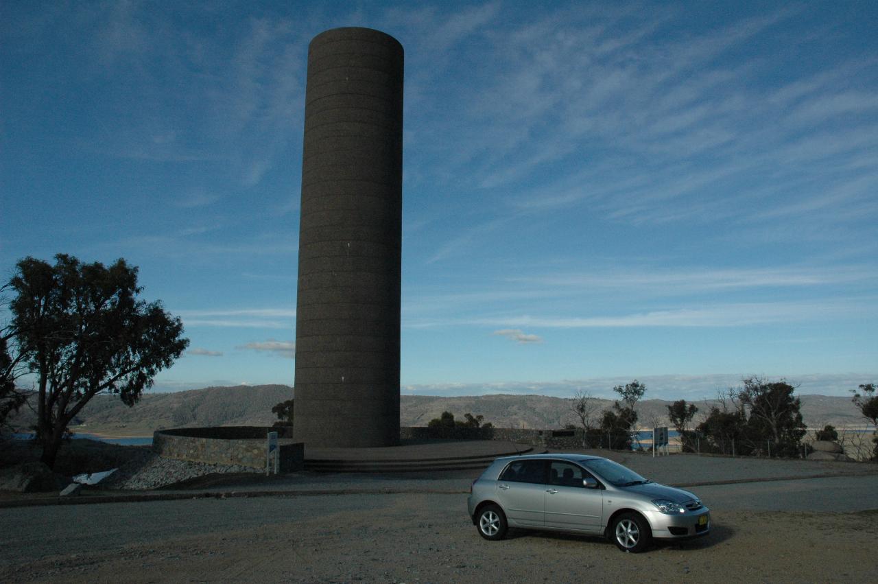
Big, isn't it! But what is it? It's a surge tank, in the form of a concrete tower. What's it for? Well, this is above Lake Jindabyne (just visible below the tree on the left), and is part of the tunnel running from here to Island Bend, a distance of 9.8km (about 6 miles), and diameter 3.8 to 4.0 metres. There is a pumping station down on the shore of Lake Jindabyne, and a pipeline from there to the start of the tunnel, underneath this tower. The surge tank absorbs the kinetic energy of the flowing water when it stops flowing. This is what causes 'hammering' in home plumbing systems, where the kinetic energy is released into the pipes themselves. With the large volume (and thus mass) of water flowing in these tunnels, great damage would be done to the tunnel and control structures if the energy could not be dissipated safely. And, hence, the surge tank. Hydro electric power stations also use surge tanks, for the same reason when they shut off a turbine. The tank itself is basically a spring; the cylinder is air tight, so when the water stops flowing along the tunnel, it has nowhere to go except into the tank where it compresses the air, which then starts resisting the flow, bringing it to a gentle halt. Then the water level will drop as the pressures equalise.
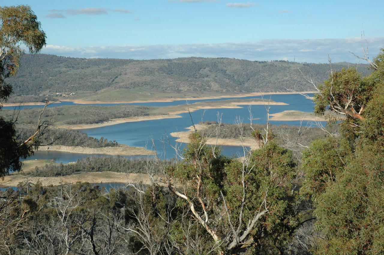
Lake Jindabyne, as seen from near the surge tank.
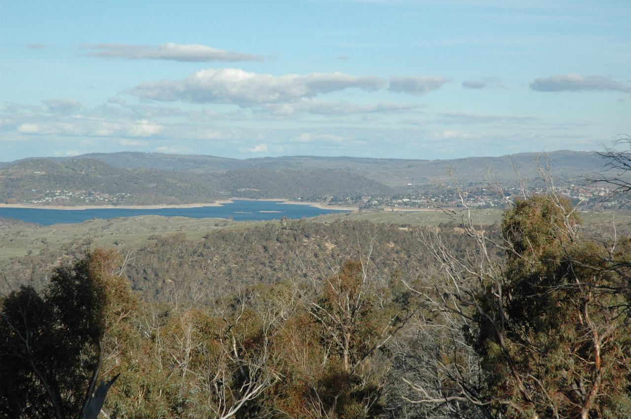
Another part of Lake Jindabyne, as seen from the surge tank lookout. The shadow on the trees in the lower left is from the tank. The town of Jindabyne is visible above the lake on the far right.
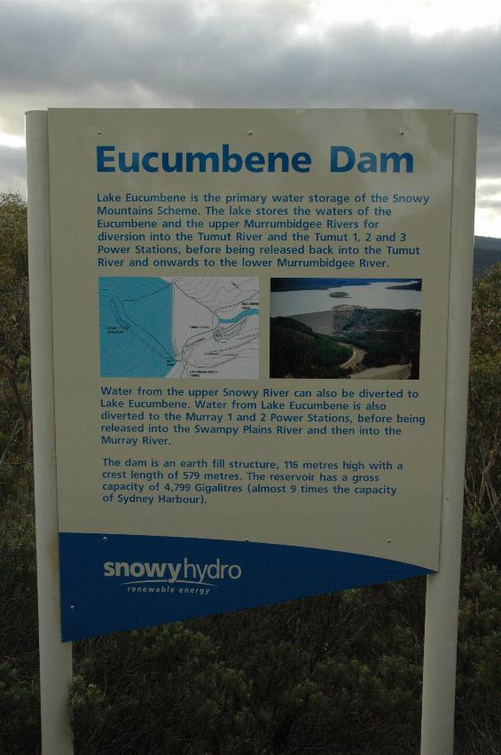
Lake Eucumbene, photographed shortly after construction, and when it was full, or very close to it. This is the primary water storage for the Snowy Mountains Scheme. It stores the waters of the Eucumbene and upper Murrimbidgee Rivers (via Tantangara Reservoir and a 16.6km tunnel) for diversion into the Tumut River and the Tumut 1, 2 and 3 power stations, before being released back into the Tumut River and onwards to the lower Murrimbidgee River.
Water from the upper Snowy River can also be diverted to Lake Eucumbene (via Island Bend Reservoir and a 23.5km tunnel). Water from Lake Eucumbene can also be diverted to the Murray 1 and 2 power stations, before being released into the Swampy Plains River and thence the Murray River.
The dam is an earth fill structure, 116 metres high, with a crest length of 579 metres. The reservoir has a gross capacity of 4,799 gigalitres (almost 9 times the capacity of Sydney Harbour).
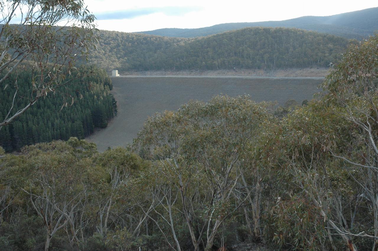
The main dam wall, as seen from a lookout near the spillway, which is built way off to the side. The little building at the far end is for access and control to the diversion tunnel. Originally built to bypass the river flow around the dam during construction, it is now used for allowing a small flow of water into the river below the wall.
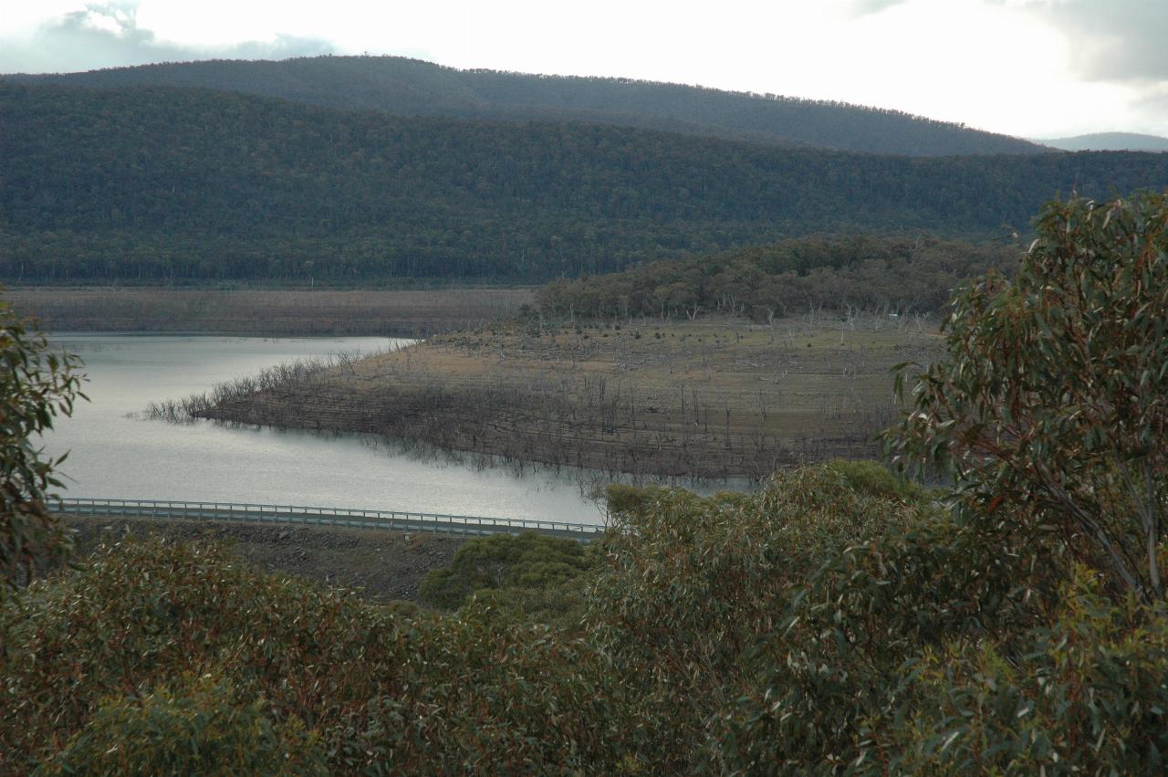
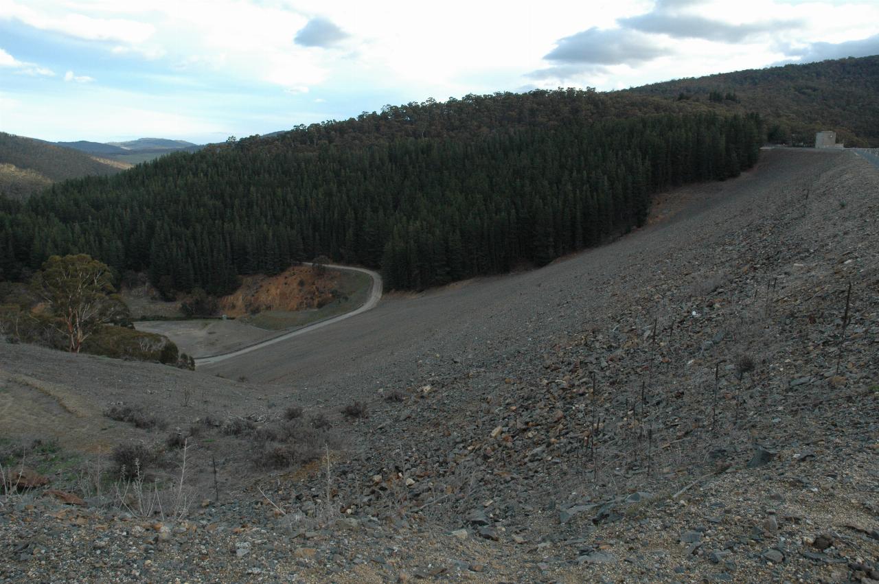
From the same lookout as the above photo, this shows the secondary wall, and the very low water level (but even more of that tomorrow!).
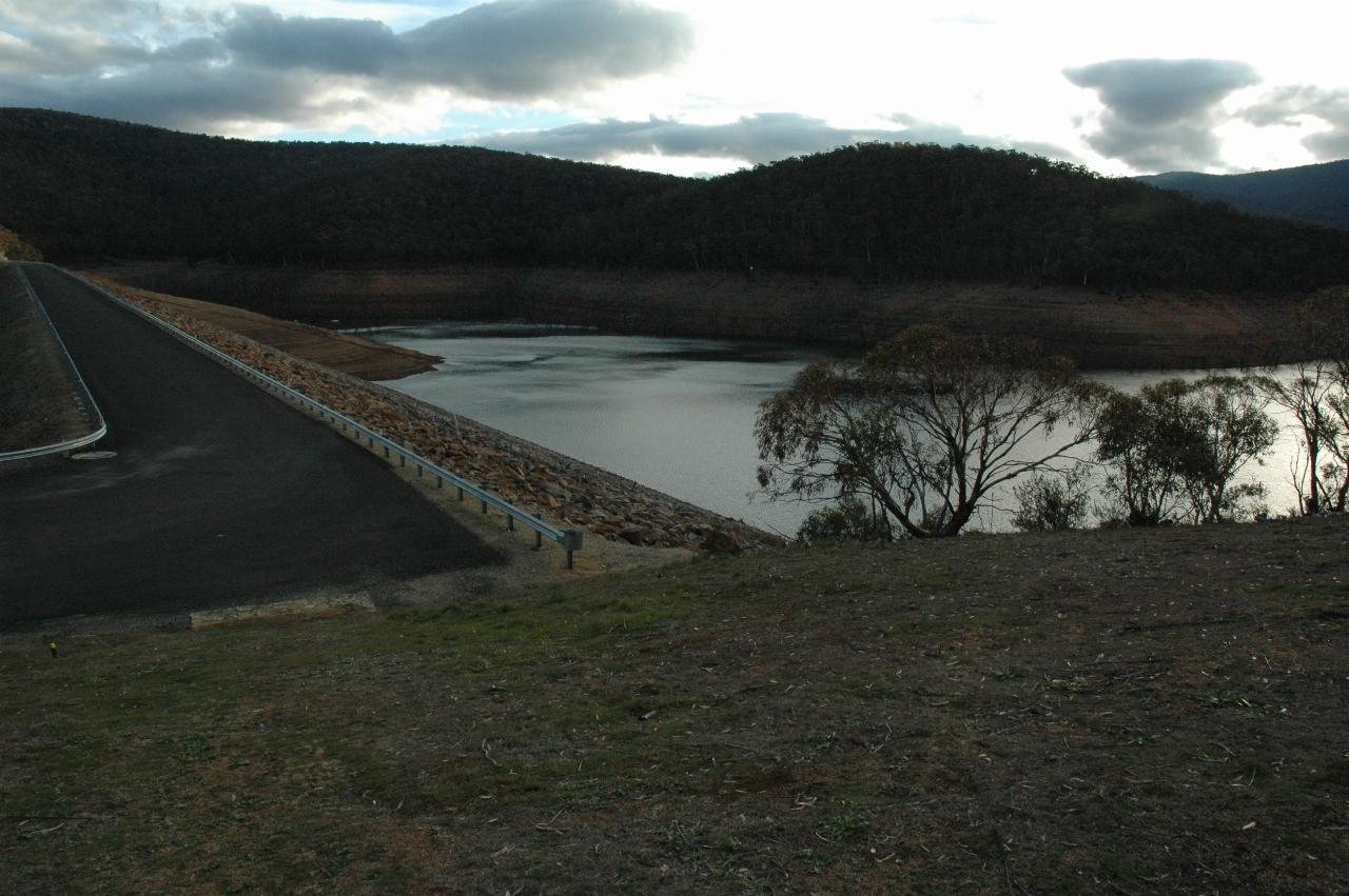
The dam wall, and low water level, from the area on the right hand side of the wall in the first photo above. During the Snowy Mountains visitor tours in the 1950s and 1960s, there used to be a restaurant on this site, but it is no longer present. But the parking lot is! There's now also a weather station.
The business side of the wall.
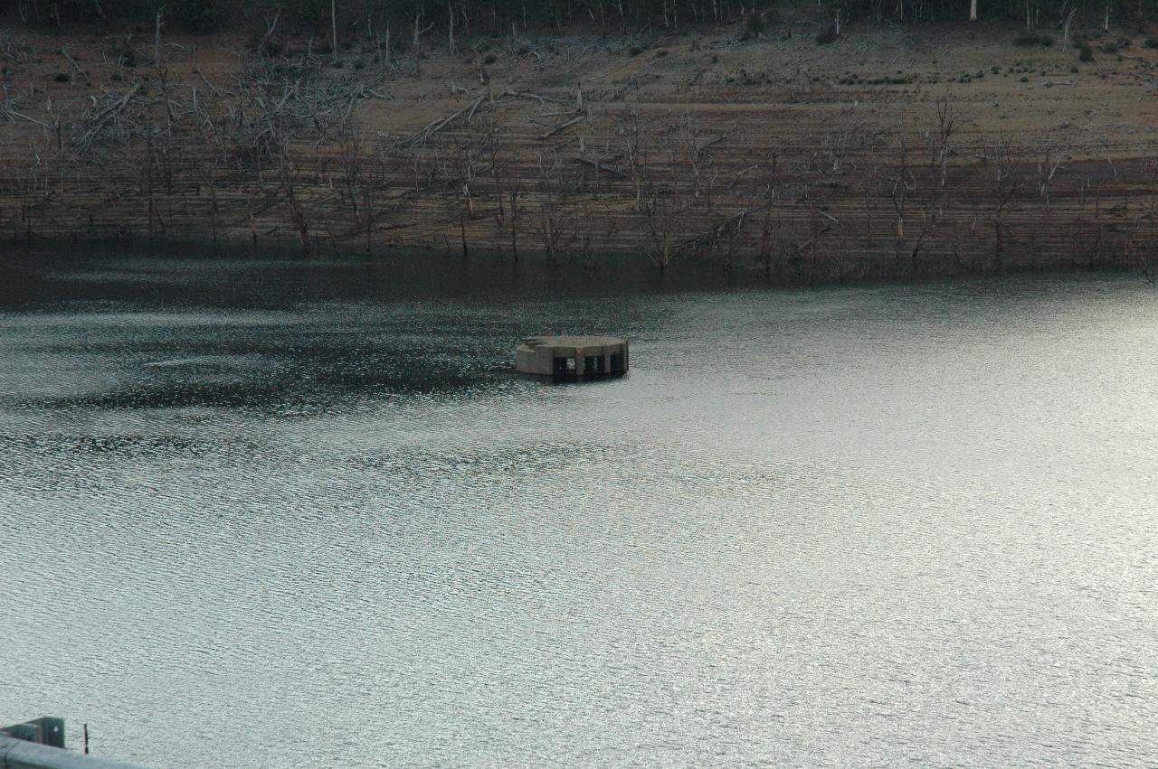
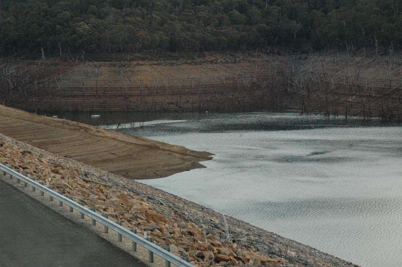
Note the inlet control structure for the diversion tunnel is starting to show. Perhaps for the first time since the dam filled up in the 1960s.
The front face of the dam. The diversion tunnel comes out near the patch of brown on the far side. There is also a road across the bottom of the dam - I suspect this was for access across the river while the wall was being constructuted.
By now it was time to start heading back to Jindabyne. The light was fading, making it difficult to take photographs, and it is also the time of day when kangaroos are likely to pop forth from the bushes. And I'd rather not run into one of them.